Meta AI' Segment Anything Model (SAM) for Geospatial Data

Project description
segment-geospatial


A Python package for segmenting geospatial data with the Segment Anything Model (SAM)
The segment-geospatial package draws its inspiration from segment-anything-eo repository authored by Aliaksandr Hancharenka. To facilitate the use of the Segment Anything Model (SAM) for geospatial data, I have developed the segment-anything-py and segment-geospatial Python packages, which are now available on PyPI and conda-forge. My primary objective is to simplify the process of leveraging SAM for geospatial data analysis by enabling users to achieve this with minimal coding effort. I have adapted the source code of segment-geospatial from the segment-anything-eo repository, and credit for its original version goes to Aliaksandr Hancharenka.
- Free software: MIT license
- Documentation: https://samgeo.gishub.org
Features
- Download map tiles from Tile Map Service (TMS) servers and create GeoTIFF files
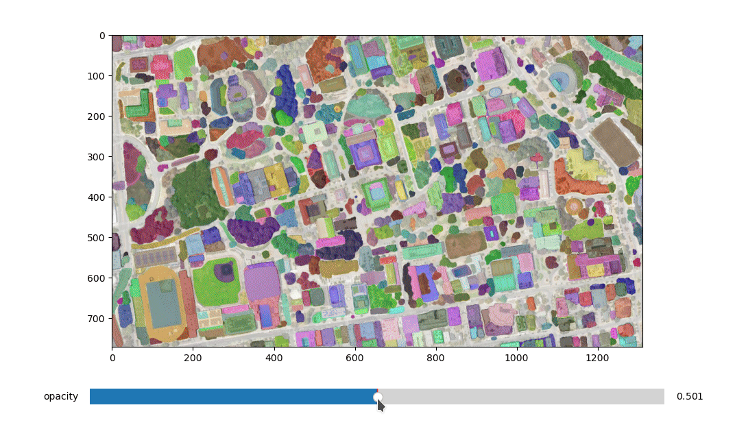
- Segment GeoTIFF files using the Segment Anything Model (SAM)
- Save segmentation results as common vector formats (GeoPackage, Shapefile, GeoJSON, etc.)
- Visualize segmentation results on interactive maps
Examples
Demos
- Automatic mask generator
Acknowledgements
This package was made possible by the following open source projects. Credit goes to the developers of these projects.
Release history Release notifications | RSS feed


Download files
Download the file for your platform. If you're not sure which to choose, learn more about installing packages.
Source Distribution
Built Distribution
Hashes for segment_geospatial-0.4.0-py2.py3-none-any.whl
| Algorithm | Hash digest | |
|---|---|---|
| SHA256 | fb07b43242233e20728feea80ba20338f44cc6f996d3830ffd01a6862596794a |
|
| MD5 | 89210bc19fe96ae15abda66ccfa9dcc3 |
|
| BLAKE2b-256 | a29122e9d7fcbd219261dd0094959cea503baa808bb30bcea44fbbe98e9a0afa |


