UASsist: Assistant for Unmanned Aircraft System photogrammetry for surveying and mapping applications.

Project description
uassist


**UASsist: Assistant for Unmanned Aircraft System photogrammetry for surveying and mapping applications. **
- Free software: GNU General Public License v3
- Documentation: https://nathanmckinney.github.io/uassist
Features
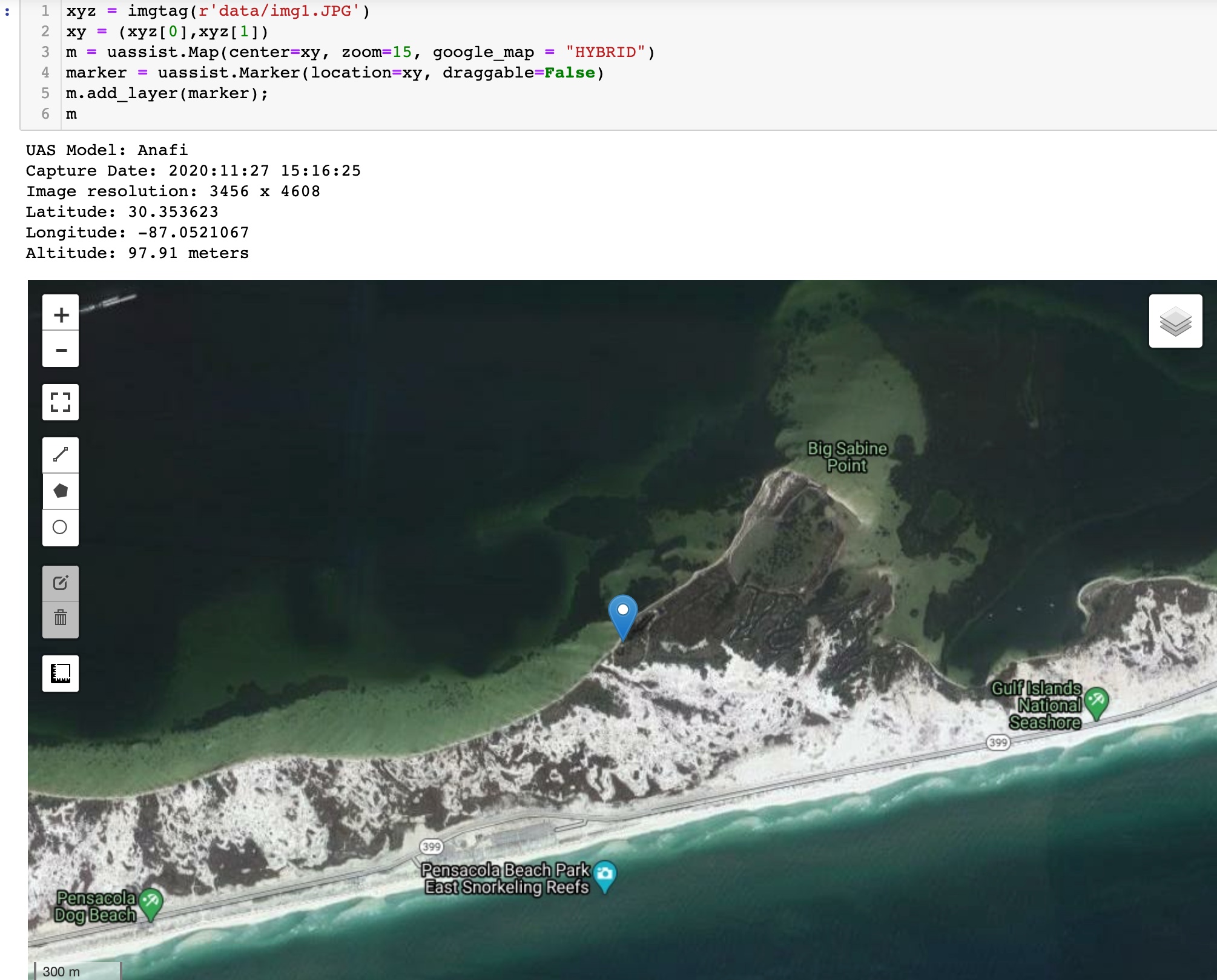
- Reads image metadata and displays information important for UAS surveys
- Displays photo coordinates on a map embedded in a notebook
Credits
This package was created with Cookiecutter and the giswqs/pypackage project template.


Download files
Download the file for your platform. If you're not sure which to choose, learn more about installing packages.
Source Distribution
uassist-0.0.6.tar.gz
(10.0 kB
view hashes)
Built Distribution
Close
Hashes for uassist-0.0.6-py2.py3-none-any.whl
| Algorithm | Hash digest | |
|---|---|---|
| SHA256 | 25a5ee1c2d5bd1565e287b287a0884bc537f422d5f3823cc3f107f4ee8ae3797 |
|
| MD5 | 44a6a26d62ac6f2f460f878d310090d1 |
|
| BLAKE2b-256 | a46e0954e4bebe8e6a48abbbbd6292c908090170507ed3e57659e9b40884b04a |


