Project description
uassist


**UASsist: Assistant for Unmanned Aircraft System photogrammetry for surveying and mapping applications. **
Features
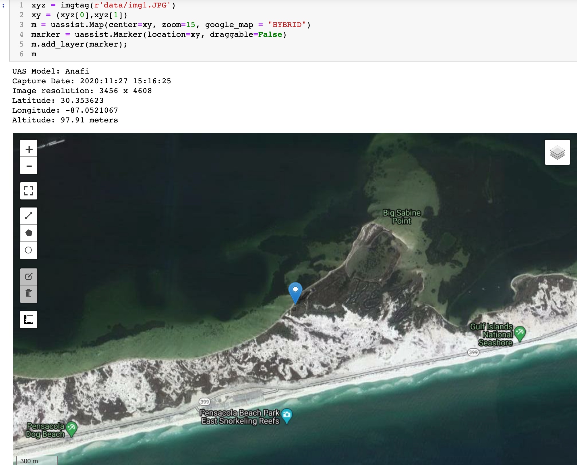
- Reads image metadata and displays information important for UAS surveys
- Displays photo coordinates on a map embedded in a notebook
- Input single image or folder containing multiple images
- Folder inputs will calculate average, min, max altitude for project and range of timestamps
- Change basemaps and upload geojson or shapefiles to display map
- Converts image locations and attributes to files:
- CSV text
- GEOJSON
- KML
- GEOPACKAGE
- ESRI Shapefile
- TODO:
- Create project metadata file
- Separate images into sub project folders using breaks in timestamp
- Create flight pattern lines
- Check EXIF altitude over DEM elevation
Credits
This package was created with Cookiecutter and the giswqs/pypackage project template.
Download files
Download the file for your platform. If you're not sure which to choose, learn more about installing packages.
Source Distribution
Built Distribution
File details
Details for the file uassist-0.0.7.tar.gz.
File metadata
-
Download URL:
uassist-0.0.7.tar.gz
- Upload date:
- Size: 11.7 kB
- Tags: Source
-
Uploaded using Trusted Publishing? No
- Uploaded via: twine/3.4.1 importlib_metadata/4.0.1 pkginfo/1.7.0 requests/2.25.1 requests-toolbelt/0.9.1 tqdm/4.60.0 CPython/3.9.4
File hashes
Hashes for uassist-0.0.7.tar.gz
| Algorithm |
Hash digest |
|
| SHA256 |
772afb88080d0d5e1e56a19ac4bb555f892465c4f6d863a042c0fce1ec1c3ecb |
|
| MD5 |
7a37295e31159783856050ff09fed770 |
|
| BLAKE2b-256 |
544a9e595fc95d3213cd953fedcf9f19a973f3742d89c7c98d1e3ba42d544a7a |
|
See more details on using hashes here.
File details
Details for the file uassist-0.0.7-py2.py3-none-any.whl.
File metadata
-
Download URL:
uassist-0.0.7-py2.py3-none-any.whl
- Upload date:
- Size: 12.3 kB
- Tags: Python 2, Python 3
-
Uploaded using Trusted Publishing? No
- Uploaded via: twine/3.4.1 importlib_metadata/4.0.1 pkginfo/1.7.0 requests/2.25.1 requests-toolbelt/0.9.1 tqdm/4.60.0 CPython/3.9.4
File hashes
Hashes for uassist-0.0.7-py2.py3-none-any.whl
| Algorithm |
Hash digest |
|
| SHA256 |
edc1af5fd202f66e335e51a71ed6b96a64faf4ee4dfe9eb5c4eb426ab0321cd3 |
|
| MD5 |
513fe97170bd797f99671b25659353f8 |
|
| BLAKE2b-256 |
c5737b3bebcdece08eb4f6a5eb08ba35efd8b50a124168959b605b3b4e72daf2 |
|
See more details on using hashes here.


