Wagtail-Geo-Widget is the complete map solution for your Wagtail site.


Project description


Wagtail-Geo-Widget
Wagtail-Geo-Widget is the complete map solution for your Wagtail site.
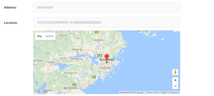
Screen1
Features
Real spatial support (with GeoDjango and PointField)
Storing coordinates as strings (for no-GeoDjango setups)
StreamField integration
Searching with geoencoding
Inline panel support
Optional address search field
Language support
Documentation
Contributing
Want to contribute? Awesome. Just send a pull request.
License
Wagtail-Geo-Widget is released under the MIT License.
Release history Release notifications | RSS feed


Download files
Download the file for your platform. If you're not sure which to choose, learn more about installing packages.
Source Distribution
wagtailgeowidget-5.0.2.tar.gz
(9.4 kB
view hashes)


